weatherTAP now offering GOES-17 satellite imagery
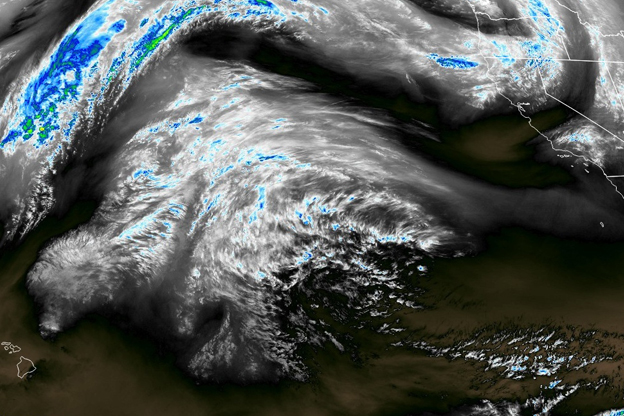
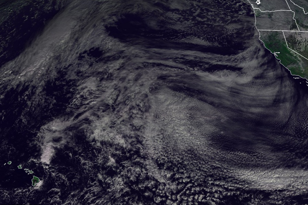
Above are some images of the GOES-17 imagery currently available on weatherTAP.com. NOAA hasn’t declared GOES-17 fully operational yet so the data is preliminary and undergoing testing. GOES-17 is supposed to be fully operational in January 2019.
The GOES-16 and GOES-17 satellite imagery is the National Oceanic and Atmospheric Administration’s next generation of geostationary weather satellites. Currently GOES-16 covers the Eastern Hemisphere of North America. GOES-17 will cover the Western Hemisphere once operational.
GOES-16 & GOES-17 are:
- five times faster than previous satellites
- Have three times more spectral channels
- Have four times greater spatial resolution.
Data from GOES-16 & GOES-17 will:
- Increase the warning lead time for thunderstorms and tornadoes
- Improve hurricane track and intensity forecasts
- Improve aviation flight route planning and air quality alerts
- Provide near real-time lightning data with he Geostationary Lightning Mapper
WeatherTAP shows several GOES-16 & GOES-17 satellite types including:
- Visibile
- Color
- Infrared
- Enhanced Infrared
- Water Vapor
- Enhanced Water Vapor
WeatherTAP has several GOES-16 & GOES-17 products including:
- Full disk scan
- CONUS views
- Puerto Rico
- Hawaii
- Alaska
- Mesoscale sectors 1 & 2
All images can be zoomed down to state level, panned and animated.
Get a free trial to weatherTAP.com today and access our exclusive GOES-16 and GOES-17 satellite information as well as, local forecasts, real-time radar, lightning data, RadarLab HD+, professional aviation weather and tropical weather. And weatherTAP is always advancing so you can access a growing set of products, including weatherTAP GLOBAL and model data. There's no risk, and no commitment, so try it today!