
FAQ's
- Q Why do I see rain in the weatherTAP app, but I don't see it when I look out my window?
-
What you see on the map is a visualization of radar echoes. Sometimes weak echoes will appear on the radar image even though there is no precipitation. These types of echoes are particularly common when the radar site is in the extremely sensitive Clear Air mode. There are three general classes of non-precipitation echoes: atmospheric effects, ground clutter, and false echoes.
Atmospheric Effects
It is possible (and even likely) that small echoes will be returned even on a clear day. Many things can reflect small amounts of radar energy including clouds, smoke, and fog. Even atmospheric effects like inversion layers and the variation in air density introduced by temperature variation can produce echoes. These echoes are not errors or problems with the radar, they are legitimate metrological, non-precipitation phenomenon detected by the radar. Echoes from atmospheric phenomenon are usually characterized by large uniformly colored areas usually centered around the radar site.
Ground Clutter
Another class of non-precipitation echo is "ground clutter". These reflections are usually caused by obstacles on the ground, including buildings, mountains, antenna towers, etc. "Ground" clutter does not necessarily have to be ground based. Aircraft, birds, and insects may also clutter a NEXRAD image. Clutter echoes are usually characterized by small points of reflected energy distributed in seemingly random pattern.
False Echoes
The third class of non-precipitation echoes is false echoes. These can occur when variations in air density cause the radar signal to refract (or bend) into the earth. The reflected signal is then refracted back to the dish where it shows up as a very strong echo. This situation is rare, but it has been observed.
- Q How do I know whether I'm looking at real precipitation or non-precipitation echoes?
-
A: Identifying Precipitation
The first clue to identifying precipitation is to determine the operating mode of the radar, Clear Air mode or Precipitation mode. If the radar is in Precipitation mode, then there is a good chance that all of the visible echoes are indeed precipitation. Examining the strength of the echoes will not only indicate whether it is precipitation, but also the intensity of the precipitation. Precipitation usually reflects at least 15 dBz. Precipitation usually occurs in large clumps of activity with strong echoes in the middle and weaker echoes at the perimeter. Precipitation has a very characteristic look and is easy to identify with a little practice. Perhaps the best way to distinguish precipitation from non-precipitation echoes is to animate the radar image. Precipitation will move whereas most non-precipitation echoes will be stationary.
- Q How do I view the forecast and current conditions?
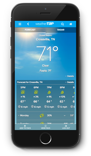
- A: Either (1) tap and hold any location on the map or (2) tap a forecast button for any location in the Locations list.
- Q What can I do if I am experiencing issues due to iOS 4.0?
- A: It is recommended that you update your version of iOS using iTunes. This will improve your iPhone's ability to run the weatherTAP app, as well as many other applications.
- Q Why do I get a "No recent data... " or "View the NWS status page" message?
- A: This message is displayed when a particular radar site has not sent any new data for some time, usually more than an hour. This is often due to maintenance, scheduled or otherwise, on that particular radar site. The message will disappear as soon as that radar site begins sending new data. In the meantime, you will likely be able to get radar data for your area by selecting another nearby radar site.
This support page is currently being constructed as we compile common questions from the weatherTAP app users like you.
You can familiarize yourself with some of the app's features by visiting
the the weatherTAP app homepage.
If you don't find the help you need, contact us by phone at 1-866-469-9982 or by email and we'll respond ASAP.
